
Kitzbühel
 At the Bikepark & Bergbahn St. Johann • only 20 minutes to Kitzbühel • Hiking and climbing at the Wilder Kaiser • SuperSki Card ski pass with 2,750 km of slopes
At the Bikepark & Bergbahn St. Johann • only 20 minutes to Kitzbühel • Hiking and climbing at the Wilder Kaiser • SuperSki Card ski pass with 2,750 km of slopes
Zillertal
1,300 km of bike tours • Top bike destination in the Alps • Hiking & climbing • 179 lifts / 508 km of slopes • Only 600 m to the Hochzillertal ski area • 10 min to the Zillertal Arena
1,300 km of bike tours • Top bike destination in the Alps • Hiking & climbing • 179 lifts / 508 km of slopes • Only 600 m to the Hochzillertal ski area • 10 min to the Zillertal Arena
Bad Kleinkirchheim / Carinthia
In town: St. Kathrein Thermal Spa & Römerbad • 15 minutes from the most beautiful bathing lakes in Carinthia • incl. Sunshine Card • September & October including Carinthia Card with free cable car & more
In town: St. Kathrein Thermal Spa & Römerbad • 15 minutes from the most beautiful bathing lakes in Carinthia • incl. Sunshine Card • September & October including Carinthia Card with free cable car & more
Garmisch
 Great location in the Kuhflucht nature and recreation park with views of the Zugspitze and Alpspitze • 5km to Garmisch-Partenkirchen • Eibsee • Partnachklamm • Near the hotel: heated outdoor pool, sports center
Great location in the Kuhflucht nature and recreation park with views of the Zugspitze and Alpspitze • 5km to Garmisch-Partenkirchen • Eibsee • Partnachklamm • Near the hotel: heated outdoor pool, sports center
Stubai Valley / NEW: now open
Open since November 15, 2024 • Skiing at over 3,000 m • Austria's largest glacier • 4 ski areas • Alpine pastures and mountain lakes • Stubai High Trail • Schlick 2000 Bike Park
Open since November 15, 2024 • Skiing at over 3,000 m • Austria's largest glacier • 4 ski areas • Alpine pastures and mountain lakes • Stubai High Trail • Schlick 2000 Bike Park
Oberstdorf
Germany's southernmost holiday resort • perfect starting point for mountain hikes and bike tours • 200 km of hiking trails at all altitudes • Germany's largest and highest ski area
Germany's southernmost holiday resort • perfect starting point for mountain hikes and bike tours • 200 km of hiking trails at all altitudes • Germany's largest and highest ski area
Montafon
Piz Buin, Silvretta-Montafon with 300km of ski slopes • Silvretta High Alpine Road • directly at the Mountain Beach, 270km of bike trails
Piz Buin, Silvretta-Montafon with 300km of ski slopes • Silvretta High Alpine Road • directly at the Mountain Beach, 270km of bike trails
Hinterstoder
Ideal location at the valley station of the Hinterstoder cable car • Just a few steps from the village center • Active Card: 40 free and 20 bonus services daily
Ideal location at the valley station of the Hinterstoder cable car • Just a few steps from the village center • Active Card: 40 free and 20 bonus services daily
Neuschwanstein
At the Alpspitzbahn in Nesselwang with summer tobogganing & Alpspitzkick • only 20 minutes to the royal castles • slopes, ski school, children's ski area & daily night skiing directly at the hotel
At the Alpspitzbahn in Nesselwang with summer tobogganing & Alpspitzkick • only 20 minutes to the royal castles • slopes, ski school, children's ski area & daily night skiing directly at the hotel
Berchtesgaden
A few minutes from the famous Königssee • Berchtesgaden National Park • Watzmann • Kehlsteinhaus • Berchtesgaden Salt Mine • Outdoor pool only 200 m away • NEW: Jenner cable car
A few minutes from the famous Königssee • Berchtesgaden National Park • Watzmann • Kehlsteinhaus • Berchtesgaden Salt Mine • Outdoor pool only 200 m away • NEW: Jenner cable car
Ötztal
AREA 47 • 1,600 km of hiking trails • 870 km of mountain bike routes • WIDIVERSUM • Ötzi Village • Umhausen Birds of Prey Park • Stuibenfall
AREA 47 • 1,600 km of hiking trails • 870 km of mountain bike routes • WIDIVERSUM • Ötzi Village • Umhausen Birds of Prey Park • Stuibenfall
Ski tour to Sonntagsköpfl in the Zillertal
Enjoyable ski tour from Hochfügen to Sonntagsköpfl
So close to the ski area, yet far from the hustle and bustle. Hidden away from the Hochfügen ski area are some fine touring peaks, such as the Sonntagsköpfl. Immerse yourself in the fantastic winter landscape and enjoy the tranquility of nature.
Wir übernehmen keine Haftung für die Richtigkeit, Vollständigkeit oder Aktualität der wiedergegebenen Informationen. Wir empfehlen die Mitnahme einer zusätzlichen Karte.
Vor dem Start der Tour sind die örtlichen Gegebenheiten wie Pistensperrungen, Lawinensituation und weitere Faktoren zu beachten.
Zur Ausrüstung gehört eine Skitourenausrüstung mit LVS-Gerät, Lawinenschaufel und Lawinensonde.
Die Tour führt teilweise durch Wald und Gelände, bitte beachte die DSV Umweltregeln sowie die Verhaltenshinweise des DAV.
Jan.
Feb.
März
April
Mai
Juni
Juli
Aug.
Sep.
Okt.
Nov.
Dez.
alpin
gering bis mittel - je nach Spurwahl; Abfahrtsvariante B: hoch
keine,
Das könnte Dich auch interessieren

Hike
3 summit round trip
Hike 3 panoramic peaks during your holiday in the Zillertal

ski tours
Scenic ski tour to the Soldatenkreuz
Ski tour to the Soldatenkreuz near the Explorer Hotel Bad Kleinkirchheim

ski tours
Popular ski tour classic to the Ellmauer Tor and Hintere Goinger Halt
Ski tour on the Wilder Kaiser in Tyrol: Through the Kübelkar to the Ellmauer Tor

Mountain bike
Bike tour to the Kapaunsalm in the Zillertal
Zillertal: Tour tip for your holiday at the Explorer Hotel Zillertal in Kaltenbach

ski tours
The Harschbichel - ideal ski tour for beginners and evening hikers
Ski tour on the Harschbichl in St. Johann in Tirol, Austria
Mountain bike
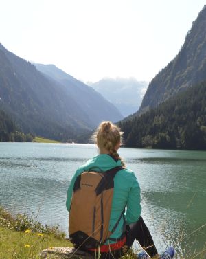
E-bike tour to the Stillup reservoir
E-bike tour from the Explorer Hotel Zillertal to the Stillup reservoir